
Ordnance Survey
OS Explorer Map Active OL19 Howgill Fells (OS Explorer Active Map)
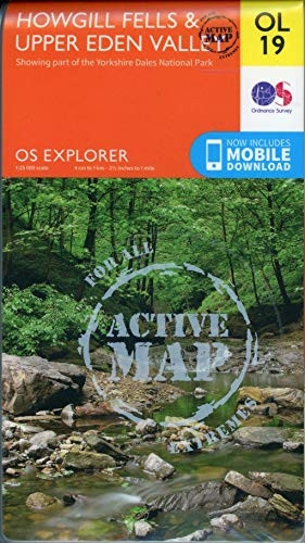
- ISBN 13:
- 9780319475362
- author:
- Ordnance Survey
- format:
- Map
- publisher:
- Ordnance Survey October 2016 ed edition
- language:
- English
- Publication Year:
- 2016
- Pages:
- 1
- Dimensions:
- 24.4 x 2 x 14.2 cm
- Genre:
- Sports, Hobbies & Games, Fishing, Birdwatching & Other Outdoor Pursuits, Active Pursuits, Ordnance Survey,OS Explorer Map Active OL19 Howgill Fells (OS Explorer Active Map),Ordnance Survey,0319475360,General Folded Maps & Walking Guides,Fishing, B
- Condition:
- New
- Availability:
- Item usually sent within 2 working days

Description
Explore the stunning landscape of the Howgill Fells, a map sheet from the Ordnance Survey's Explorer series. This detailed and easy-to-read map covers Appleby-in-Westmorland, the Howgill Fells, Sedbergh, Upper Eden Valley and Kirkby Stephen, including the Yorkshire Dales National park and North Pennines.
Features of the map include tourist information points, popular sites, viewpoints, places of interest and rights of way information. The map is available in an active weatherproof version, making it perfect for outdoor enthusiasts and those planning to explore the area.
Scale: 1:25,000. A useful tool for anyone planning to visit or navigate the Howgill Fells, this map provides essential information to help you make the most of your trip.
Related Products
Related Products

OS Explorer Map OL19 Howgill Fells
Ordnance Survey
OS Explorer Map Active (109) Bodmin Moor (OS Explorer Active Map)
Ordnance Survey

OS Explorer Map Active (106) Newquay and Padstow (OS Explorer Active Map)
Ordnance Survey

OS Explorer Map Active (216) Welshpool and Montgomery (OS Explorer Active Map)
Ordnance Survey
OS Explorer Map Active (115) Exmouth and Sidmouth (OS Explorer Active Map)
Ordnance Survey