
Ordnance Survey
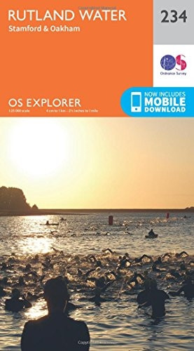
OS Explorer Map (234) Rutland Water, Stamford and Oakham
- ISBN 13:
- 9780319244272
- author:
- Ordnance Survey
- format:
- Map
- publisher:
- Ordnance Survey
- language:
- English
- Publication Year:
- 2015
- Pages:
- 1
- Dimensions:
- 24.2 x 5.4 x 13.5 cm
- Genre:
- Sports, Hobbies & Games, Fishing, Birdwatching & Other Outdoor Pursuits, Active Pursuits
- Condition:
- New
- Availability:
- Item usually sent within 2 working days

Description
Discover Rutland Water and its surrounding countryside with this Ordnance Survey Explorer map. The 1:25,000 scale map covers an area of approximately 4 cm to 1 km, providing detailed information for walkers, hikers, cyclists, and horse riders. The map includes roads, rights of way, permissive paths, and bridleways, as well as essential visitor information. Explore the thriving market towns of Oakham, Uppingham, and Stamford, including Burghley House, a stunning Elizabethan stately home. Enjoy watersports on Rutland Water or spot rare ospreys in the nature reserve. A free digital download is included with this map, allowing you to access the information on your device. This map is part of Ordnance Survey's Explorer series and complements other maps for Lincolnshire, such as Grantham 247 and Wisbech & Peterborough North 235.
Related Products
Related Products

OS Explorer OL42 Kielder Water & Forest (OS Explorer Map)
Ordnance Survey

OS Explorer ACTIVE OL42 Kielder Water & Forest (OS Explorer Map Active)
Ordnance Survey

OS Explorer OL51 Atholl (OS Explorer Map)
Ordnance Survey
OS Explorer OL9 Exmoor (OS Explorer Map)
Ordnance Survey

OS Explorer OL46 The Trossachs (OS Explorer Map)
Ordnance Survey