
Ordnance Survey
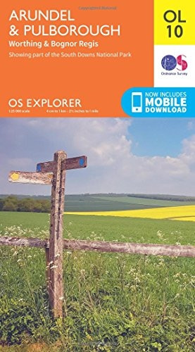
OS Explorer OL10 Arundel & Pulborough (OS Explorer Map)
(No reviews yet)
Write a Review
- ISBN 13:
- 9780319242490
- author:
- Ordnance Survey
- format:
- Map
- publisher:
- Ordnance Survey
- language:
- English
- Publication Year:
- 2015
- Pages:
- 1
- Dimensions:
- 24.1 x 7.7 x 13.5 cm
- Genre:
- Sports, Hobbies & Games, Fishing, Birdwatching & Other Outdoor Pursuits, Active Pursuits
- Condition:
- New
- Availability:
- Item usually sent within 2 working days

Description
Explore the beautiful South Downs National Park, the charming town of Arundel, and the stunning coastline between Bognor Regis and Worthing with this Ordnance Survey map.
Featuring the River Arun, which flows through Pulborough and Arundel, this map provides detailed and informative coverage of the area, including Monarch's Way and part of the South Downs. Perfect for walkers, hikers, cyclists, and navigators, this map is a must-have for anyone planning a trip to this scenic region.
Available as a map and with a mobile download option, this Ordnance Survey publication is a reliable and authoritative guide to the area.
Related Products
Related Products
OS Explorer OL9 Exmoor (OS Explorer Map)
Ordnance Survey
£12.33
Detailed map of Exmoor National Park from Ordnance Survey, covering the area between Barnstaple and Minehead. This map features 1000km of footpaths and bridleways, providing a comprehensive guide for...

OS Explorer OL51 Atholl (OS Explorer Map)
Ordnance Survey
£12.33
Atholl, Glen Tilt, Beinn Dearg & Carn Nan Gabhar is an Ordnance Survey Explorer map, providing detailed information for outdoor enthusiasts. This map covers essential routes and paths in the area,...

OS Explorer OL45 The Cotswolds (OS Explorer Map)
Ordnance Survey
£12.33
The Cotswolds, Burford, Chipping Campden, Cirencester & Stow-on-the-Wold OS Explorer map provides detailed information for those enjoying outdoor activities such as walking, horse riding, and...

OS Explorer OL46 The Trossachs (OS Explorer Map)
Ordnance Survey
£12.33
The Trossachs Explorer Map is a detailed folding map of the area, ideal for outdoor enthusiasts. It features Loch Lomond & The Trossachs National Park, the West Highland Way, and the Central region,...
OS Explorer OL33 Haslemere & Petersfield (OS Explorer Map)
Ordnance Survey
£12.33
The OS Explorer Map: Haslemere & Petersfield, Midhurst & SelborneThis detailed folding map is ideal for outdoor activities such as walking, horse riding, and off-road cycling in the South Downs and...