
Reference, National Geographic Maps
Caribbean Classic, Laminated: Wall Maps Countries & Regions
- ISBN 13:
- 9781597754415
- author:
- Reference, National Geographic Maps
- format:
- Sheet Map
- publisher:
- National Geographic Maps
- language:
- English
- Publication Year:
- 2012
- Pages:
- 1
- Dimensions:
- 82 x 5.6 x 8.3 centimetres (0.36
- Genre:
- Reference & Language, Atlases, Travel,
- Condition:
- New
- Availability:
- Item usually sent within 10 working days

Description
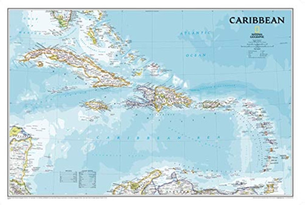
The Caribbean Classic wall map by National Geographic Maps is an authoritative and detailed guide to the islands of the Caribbean Sea. This updated edition features exceptional coverage from Florida to Colombia, Venezuela, Barbados, and Honduras, Costa Rica, and Nicaragua, showcasing the region's remarkable seafloor variation and over 1,000 named places. The map includes informative notes about the region's history and unique geography, as well as National Geographic's world-recognized proprietary fonts and bright colors. Printed on premium quality paper stock, laminated, and rolled, this poster-size map is easy to frame and provides a beautiful addition to any décor or educational setting. With its oblique Mercator Projection and scale of 1:3,250,000 (1" = 51 miles), the Caribbean Classic wall map offers an unparalleled level of detail for business or education reference.
Related Products
Related Products

Caribbean Classic, tubed Wall Maps Countries & Regions
Maps, National Geographic

Collins World Wall Laminated Map
Maps, Collins

Captain Blood: with two explanatory maps of the Caribbean region (Aziloth Books)
Sabatini, Rafael

Portugal Centro Regional Map 592 (Michelin Regional Maps)
Michelin

Portugal Norte Regional Map 591 (Michelin Regional Maps)
Michelin